Slika:PtolemyWorldMap.jpg
Pojdi na navigacijo
Pojdi na iskanje

Velikost tega predogleda: 800 × 547 točk. Druge ločljivosti: 320 × 219 točk | 640 × 438 točk | 1.024 × 700 točk | 1.280 × 876 točk | 1.500 × 1.026 točk.
Izvorna datoteka (1.500 × 1.026 točk, velikost datoteke: 867 KB, MIME-vrsta: image/jpeg)
Povzetek
| Opis |
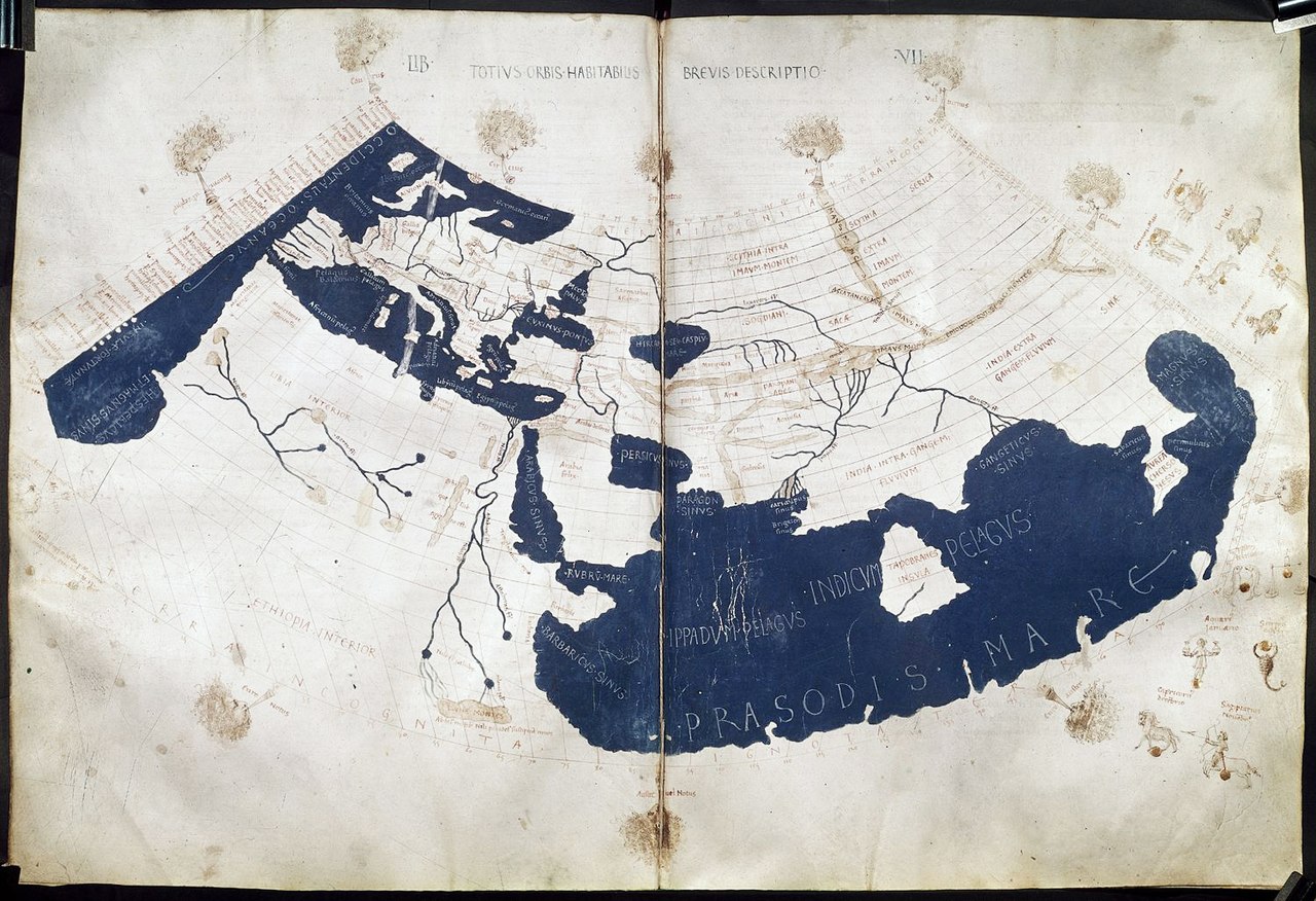
English: A mid-15th century Florentine map of the world based on Jacobus Angelus's 1406 Latin translation of Maximus Planudes's late-13th century rediscovered Greek manuscripts of Ptolemy's 2nd-century Geography. Ptolemy's 1st (modified conic) projection. 中文:《托勒密世界地图》,原为克劳狄乌斯·托勒密所著《地理学》书中所附的多幅地图,后来由君士坦丁堡的希腊修士马克西姆·普拉努德斯等人重新编集,并由14世纪的意大利学者雅各布·安格鲁斯译为拉丁文。该地图15世纪中期在佛罗伦萨出版。 |
| Datum | ad 1450–1475 |
| Vir | Ptolemy's Geography (Harleian MS 7182, ff 58–59) |
| Avtor | Credited to Francesco di Antonio del Chierico |
Licenca
|
To je zvesta fotografska reprodukcija izvornega dvorazsežnega umetniškega dela. Samo umetniško delo je v javni domeni iz naslednjega razloga:
Uradno stališče Fundacije Wikimedija je, da so »zveste reprodukcije dvorazsežnih del v javni domeni in da so nasprotne trditve napad na samo pojmovanje javne domene«. Podrobnosti so na razpolago na strani Commons:When to use the PD-Art tag.
V javni domeni je torej tudi ta fotografska reprodukcija. Zaradi krajevnih zakonov je v nekaterih jurisdikcijah uporaba prikazane vsebine lahko tudi prepovedana ali omejena. Glej Commons:Reuse of PD-Art photographs. | ||||
| Annotations | This image is annotated: View the annotations at Commons |
Zgodovina datoteke
Kliknite datum in čas za ogled datoteke, ki je bila takrat naložena.
| Datum in čas | Sličica | Velikost | Uporabnik | Komentar | |
|---|---|---|---|---|---|
| trenutno | 00:02, 28. julij 2014 | | 1.500 × 1.026 (867 KB) | wikimediacommons>Khamar | Larger scan from British Library retreived 2014-7-27 http://www.bl.uk/catalogues/illuminatedmanuscripts/ILLUMIN.ASP?Size=mid&IllID=28894 which has been slightly sharpened. Text clarity is improved in this version and the overall tint is less yellow. |
Uporaba datoteke
Datoteko uporabljata naslednji 2 strani: